 +7 (727) 236-08-78
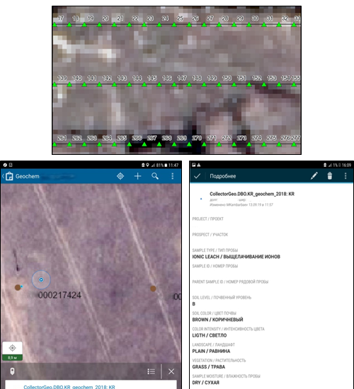 A planned sampling network and documentation log are presented as a data collecting service ESRI Collector downloaded to work tablets.
ESRI Collector is an electronic data collection program with GPS function. It enables one to record coordinates, attributive information and to maintain location-based photo documentation.
As base layers, aerial / satellite imagery data, topographic, thematic maps with locations of planned sampling can be used.
Attributive information is filled by a unified standard for all sampling points, directly on the spot.
Data collected via synchronization is transferred to a common database, which allows one to control the overall sampling and quickly process the acquired information.