 +7 (727) 236-08-78
As a rule, new generation satellites of high and ultrahigh resolution run surveys either straight within entire visible range (panchromatic) or in several, more narrow zones of spectrum (multizonal). Under otherwise equal conditions, panchromatic images have higher spatial resolution.
Procedure of pan-sharpening algorithm is used to increase spatial resolution of multispectral images by panchromatic images of ultrahigh resolution.
In the transformation process, color is imparted to panchromatic image pixels. Thus, a new multizone image is created with the same number of pixels as on the panchromatic image, hence, with the same spatial resolution but allowing for having color synthesized image
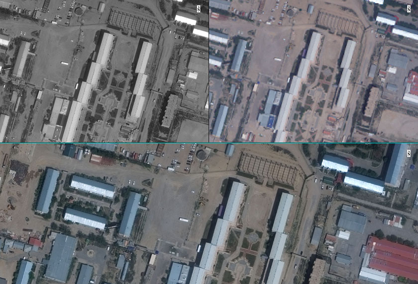
Display of Panchromatic (upper/lest) and Multispectral (upper/right) Image; Pan-sharpening (lower)